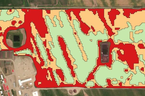
by GIS4Ag | Mar 26, 2025
Unlock the power of precision agriculture with this practical, hands-on mini-course designed to help you create accurate, multi-year customized management zones and variable rate prescriptions using entirely free satellite NDVI data and the open-source QGIS software....
by GIS4Ag | Feb 19, 2025
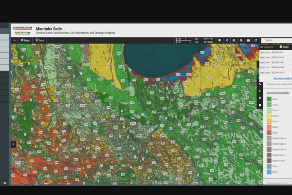
Welcome to your GIS4Ag Subscription. You now have access to Manitoba’s premier Interactive Soil Map Viewer for real-time analysis of drainage, slope, and agricultural capability. To ensure you get the most out of this data, we have included our Soils 101 Course. From...
by GIS4Ag | Feb 4, 2025
Weather Insight Pro closes the gap between complex meteorological data and practical, actionable insights for the agricultural community and beyond across Canada and the United States. By integrating advanced weather models into an intuitive online mapping platform...